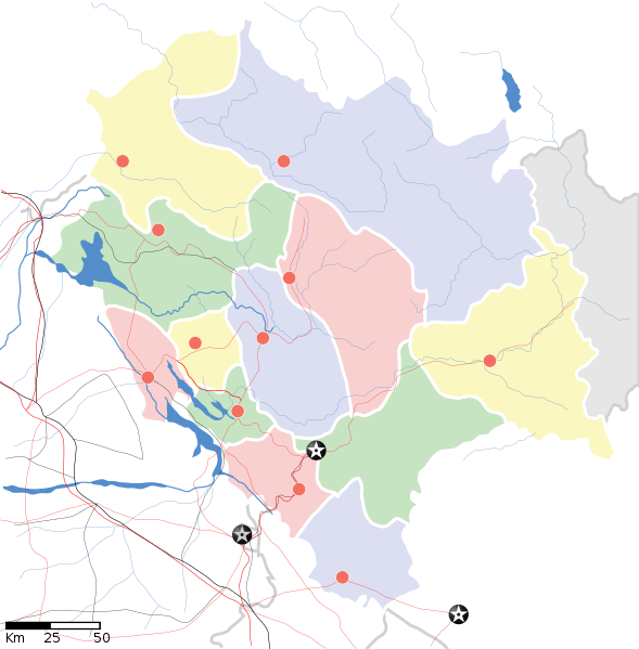
Fiùra:Himachal Pradesh locator map.svg

Grannezza 'e sta PNG mostra 'e stu SVG file: 589 × 599 pixel. Ati resoluziune: 236 × 240 pixel | 472 × 480 pixel | 755 × 768 pixel | 1 007 × 1 024 pixel | 2 013 × 2 048 pixel | 1 039 × 1 057 pixel.
File 'e origgine (File SVG, dimenziune nommenale 1 039 × 1 057 pixel, dimenzione d' 'o file: 138 KB)
Cronologgia d’’o file
Fa’ clic ncoppa a na data/ora pe vedé comme s'appresentava 'o file a chillo mumento.
| Data/Ora | Miniatura | Dimenzione | Utente | Commento | |
|---|---|---|---|---|---|
| attuale | 20:06, 14 Abb 2020 |  | 1 039 × 1 057 (138 KB) | C1MM | Reverted to version as of 08:30, 11 April 2016 (UTC) |
| 20:05, 14 Abb 2020 |  | 1 735 × 1 761 (127 KB) | C1MM | Standardized | |
| 10:30, 11 Abb 2016 |  | 1 039 × 1 057 (138 KB) | Snjsharma | Reverted to version as of 16:48, 4 June 2007 (UTC) | |
| 08:49, 14 Maj 2013 |  | 2 000 × 2 035 (854 KB) | Snjsharma | New Version. | |
| 18:48, 4 Giù 2007 |  | 1 039 × 1 057 (138 KB) | Planemad | {{WikiProject_India_Maps |Title=Himachal Pradesh locator map |Description=Map of w:Himachal Pradesh with road and rail lines. |Source= |Date=June 2007 |Author=w:user:Planemad }} Category:WikiProject India State Maps |
Jonte ê ffiure
Pe sta paggena ce buò stu file:
Auso globbale d’’o file
'E wiki ccà abbascio aúsano stu file:
- Uso ncopp'a ar.wikipedia.org
- Uso ncopp'a ast.wikipedia.org
- Uso ncopp'a as.wikipedia.org
- Uso ncopp'a awa.wikipedia.org
- Uso ncopp'a azb.wikipedia.org
- ساری مولاق
- سادهوپول
- جاوالی, هیماچال پرادش
- سیر قوباردهان
- مالانا, هیماچال پرادش
- سیمبال, هیماچال پرادش
- ماهوناق
- جایی (هیندوستان)
- جایدوی
- جاهو (هیماچال پرادش)
- راجپور داقالی
- ایچهی (هیندوستان)
- زاکاتخانا
- هیکیم, هیماچال پرادش
- پوبووال
- پراقپور
- هالر, هیماچال پرادش
- واشیشت, هیماچال پرادش
- قوپالپور, هیماچال پرادش
- دانپور, هیماچال پرادش
- دانکار ویلیج
- قالون (هیندوستان)
- دلان, هیماچال پرادش
- دارلاقات
- دانقوه خورد
- داده (هیندوستان)
- چیتکول
- ناور-والی
- ناونی (هیندوستان)
- چاونترا
- ناکو, هیماچال پرادش
- چاکی مود
- بیر, هیماچال پرادش
- بارواین
- کیبر (هیندوستان)
- تاشیقانق
- تاکسال
Vedite ause globbale 'e stu file.